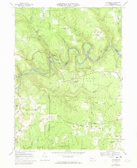
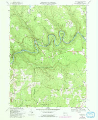
1967 Map of Cooksburg
USGS Topo · Published 1973About this map
The Clarion River snakes through this landscape, marking the transition between the dense woodlands of Cook Forest State Park and the rugged upland ridges of northwestern Pennsylvania. In the late 1960s, this area remained deeply defined by its natural resources and conservation efforts, as seen in the extensive boundaries of State Game Lands No 74 and the Allegheny National Forest. The settlement at Cooksburg serves as a gateway to the park, where a Lookout Tower and Cook Tomb stand as local landmarks among the campgrounds and picnic areas.
Find a feature on this map
67 named features on this map. Tap any name to fly to it.
Don’t see what you’re looking for? This feature index may not catch every label — zoom into the map to look around manually.
Map Details
Editions of this 1967 Cooksburg Map
5 editions found
Other maps of this area

1906 · Clarion
USGS Topo · 1:62,500

1907 · Clarion
USGS Topo · 1:62,500

1918 · Loleta
USGS Topo · 1:62,500

1922 · Tionesta
USGS Topo · 1:62,500

1924 · Tionesta
USGS Topo · 1:62,500

1924 · Brookville
USGS Topo · 1:62,500

1926 · Brookville
USGS Topo · 1:62,500

1936 · Marienville
USGS Topo · 1:48,000

1941 · Marienville
USGS Topo · 1:62,500

1944 · Brookville
USGS Topo · 1:62,500
Featured Places
- Millcreek Township, PA
- Fisher, PA
- Eldred Township, PA
- Hominy Ridge, Barnett Township
- Farmington Township, PA