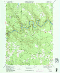
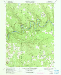
1967 Map of Cooksburg
USGS Topo · Published 1993About this map
The Clarion River winds through the heart of this landscape, marking the intersection of Clarion, Jefferson, and Forest counties during the late 1960s. The region is characterized by extensive conservation and public lands, including the old-growth tracts of Cook Forest State Park, Clear Creek State Forest, and vast reaches of State Game Lands No 283. Small settlements and family landmarks are scattered throughout the hills, such as Cooksburg, Hottelville, and Kahletown. Local history is anchored by sites like St Dominics Ch and its accompanying cemetery, while the terrain's industrial undercurrent is noted by a Strip Mine and scattered gas wells. Named ridges and hills, including Hominy Ridge and Fitzgerald Hill, provide a detailed look at the topographic character of the Allegheny National Forest southern borderlands.
Find a feature on this map
66 named features on this map. Tap any name to fly to it.
Don’t see what you’re looking for? This feature index may not catch every label — zoom into the map to look around manually.
Map Details
Editions of this 1967 Cooksburg Map
5 editions found
Other maps of this area

1906 · Clarion
USGS Topo · 1:62,500

1907 · Clarion
USGS Topo · 1:62,500

1918 · Loleta
USGS Topo · 1:62,500

1922 · Tionesta
USGS Topo · 1:62,500

1924 · Tionesta
USGS Topo · 1:62,500

1924 · Brookville
USGS Topo · 1:62,500

1926 · Brookville
USGS Topo · 1:62,500

1936 · Marienville
USGS Topo · 1:48,000

1941 · Marienville
USGS Topo · 1:62,500

1944 · Brookville
USGS Topo · 1:62,500
Featured Places
- Millcreek Township, PA
- Fisher, PA
- Eldred Township, PA
- Hominy Ridge, Barnett Township
- Farmington Township, PA