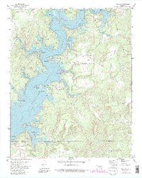
1972 Map of Cookson
USGS Topo · Published 1983About this map
The Illinois River valley defines this mid-century landscape, dominated by the waters of Tenkiller Ferry Lake. The map reveals a transition into a recreation-focused economy, with numerous public access points such as the Joliff Inlet Public Use Area and Sixshooter Camp Public Use Area lining the irregular shoreline. The settlement of Cookson sits on the eastern heights, served by the Cookson Cem and the Tenkiller Lake Landing Strip. This 1970s survey includes underwater contours for the reservoir, based on earlier Army Corps of Engineers data, while also documenting the high ridges of Canoe Mountain and Buckhorn Mountain. Evidence of earlier rural life remains in the scatter of homesteads near Red Springs and the naming of Ballew Ridge, standing in contrast to the developed state recreation areas.
Find a feature on this map
59 named features on this map. Tap any name to fly to it.
Don’t see what you’re looking for? This feature index may not catch every label — zoom into the map to look around manually.
Map Details
Editions of this 1972 Cookson Map
3 editions found
Other maps of this area

1898 · Tahlequah
USGS Topo · 1:125,000

1901 · Muscogee
USGS Topo · 1:125,000

1901 · Tahlequah
USGS Topo · 1:125,000

1905 · Muscogee
USGS Topo · 1:125,000

1905 · Tahlequah
USGS Topo · 1:125,000

1946 · Fort Smith
USGS Topo · 1:250,000

1948 · Hulbert
USGS Topo · 1:62,500

1948 · Webbers Falls
USGS Topo · 1:62,500

1950 · Hulbert
USGS Topo · 1:62,500

1950 · Webbers Falls
USGS Topo · 1:62,500