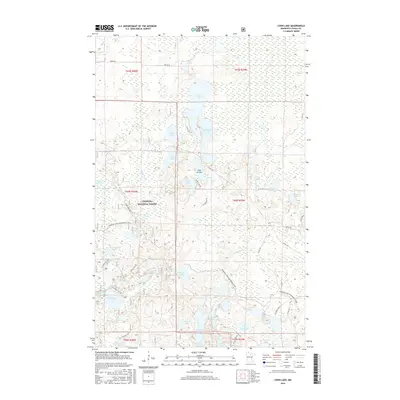
2016 Map of Coon Lake
USGS Topo · Published 2016About this map
Chippewa National Forest dominates this northern Minnesota landscape, where a dense network of glacial basins defines the topography of Itasca County. The central portion of the map is anchored by the large expanse of Coon Lake, flanked by Sandwick Lake and the descriptive Lake of Isles. This area reveals a transition from managed forest land to a recreation-focused wilderness, as evidenced by the extensive Cameron Lake Snowmobile Trail that winds through the southeastern quadrants near Canoe Lake and Little Neck Lake.
Find a feature on this map
54 named features on this map. Tap any name to fly to it.
Don’t see what you’re looking for? This feature index may not catch every label — zoom into the map to look around manually.
Map Details
Editions of this 2016 Coon Lake Map
This is the sole edition of this map. No revisions or reprints were ever made.
Other maps of this area

1919 · Release
USGS Topo · 1:62,500

1919 · Marcell
USGS Topo · 1:62,500

1943 · Release
USGS Topo · 1:62,500

1954 · Hibbing
USGS Topo · 1:250,000

1957 · Hibbing
USGS Topo · 1:250,000

1958 · Hibbing
USGS Topo · 1:250,000

1964 · Hibbing
USGS Topo · 1:250,000

1970 · Clubhouse Lake
USGS Topo · 1:24,000

1970 · Coon Lake
USGS Topo · 1:24,000
1970 · Anderson Lake
USGS Topo · 1:24,000