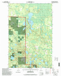
1996 Map of Coon Lake
USGS Topo · Published 1998About this map
Scenic State Park anchors this portion of Itasca County, showing a landscape defined by an intricate network of glacial lakes and managed forest boundaries. The park's core features, including Sandwick Lake and the elongated Coon Lake, are depicted with detailed shoreline infrastructure such as the State Park Headquarters and multiple boat ramps. This 1990s-era survey captures a region primarily dedicated to conservation and recreation, where the Chippewa National Forest meets the George Washington State Forest. Beyond the water, the map documents the utilitarian layers of the land, from a Sand Pit near Cedar Lake to a designated Snowmobile Trail and a Winter Trail cutting through the dense stands. Smaller water bodies like Lake of Isles and Cameron Lake suggest the remote, water-rich character of northern Minnesota before further modern development.
Find a feature on this map
38 named features on this map. Tap any name to fly to it.
Don’t see what you’re looking for? This feature index may not catch every label — zoom into the map to look around manually.
Map Details
Editions of this 1996 Coon Lake Map
This is the sole edition of this map. No revisions or reprints were ever made.
Other maps of this area

1919 · Release
USGS Topo · 1:62,500

1919 · Marcell
USGS Topo · 1:62,500

1943 · Release
USGS Topo · 1:62,500

1954 · Hibbing
USGS Topo · 1:250,000

1957 · Hibbing
USGS Topo · 1:250,000

1958 · Hibbing
USGS Topo · 1:250,000

1964 · Hibbing
USGS Topo · 1:250,000

1970 · Clubhouse Lake
USGS Topo · 1:24,000

1970 · Coon Lake
USGS Topo · 1:24,000
1970 · Anderson Lake
USGS Topo · 1:24,000