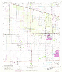
1963 Map of Cooper City
USGS Topo · Published 1970About this map
The expanding residential grids of Cooper City and Davie take shape on this 1963 survey, reflecting the mid-century transformation of the Broward County landscape. The northern portion of the map is dominated by the New River Canal and the USDA Experimental Station, while the southern reaches feature the industrial and recreational infrastructure supporting a growing population, including the Drag Strip and multiple golf courses. Local institutions like St Gregory Sch and Holy Sacrament Ch are established among the emerging subdivisions.
Find a feature on this map
35 named features on this map. Tap any name to fly to it.
Don’t see what you’re looking for? This feature index may not catch every label — zoom into the map to look around manually.
Map Details
Editions of this 1963 Cooper City Map
4 editions found
Other maps of this area

1945 · Fort Lauderdale North
USGS Topo · 1:24,000

1947 · North Miami
USGS Topo · 1:24,000

1949 · Opalocka
USGS Topo · 1:24,000

1949 · Fort Lauderdale North
USGS Topo · 1:24,000

1949 · Fort Lauderdale South
USGS Topo · 1:24,000

1950 · North Miami
USGS Topo · 1:24,000

1956 · Miami
USGS Topo · 1:250,000

1956 · West Palm Beach
USGS Topo · 1:250,000

1957 · West Palm Beach
USGS Topo · 1:250,000

1958 · West Palm Beach
USGS Topo · 1:250,000