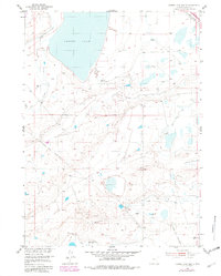
1955 Map of Cooper Lake South
USGS Topo · Published 1982About this map
Cooper Lake dominates the northern horizon of this Albany County landscape, its shores defining a high plains environment where water management was essential for ranching viability. The terrain is marked by an extensive network of irrigation efforts, including the James Lake North Canal and numerous unnamed ditches that cut across the basin. These man-made waterways supported the scattered operations of the era, most notably the Harris Ranch in the southeast.
Find a feature on this map
20 named features on this map. Tap any name to fly to it.
Don’t see what you’re looking for? This feature index may not catch every label — zoom into the map to look around manually.
Map Details
Editions of this 1955 Cooper Lake South Map
3 editions found
Other maps of this area

1895 · Laramie
USGS Topo · 1:125,000

1902 · Laramie
USGS Topo · 1:125,000

1905 · Laramie
USGS Topo · 1:125,000

1906 · Laramie
USGS Topo · 1:125,000

1908 · Laramie
USGS Topo · 1:125,000

1954 · Cheyenne
USGS Topo · 1:250,000

1955 · Bosler
USGS Topo · 1:24,000

1955 · Big Judson
USGS Topo · 1:24,000

1955 · Cooper Lake South
USGS Topo · 1:24,000

1955 · Cooper Lake North
USGS Topo · 1:24,000