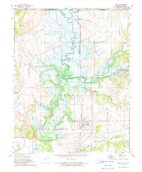
1972 Map of Copan
USGS Topo · Published 1974About this map
Little Caney River winds through the northern Oklahoma borderlands on the eve of significant hydrological change. This 1970s survey captures the landscape as workers began the Proposed Location Dam Under Constr, a massive engineering project destined to create Copan Lake. While the town of Copan remains firmly established along the Atchison Topeka and Santa Fe line, the blue-hatched shading over portions of the river valley indicates areas soon to be submerged. To the north, the small settlement of Owen sits just south of the Kansas Oklahoma state line. Rural life is evidenced by the Pleasant Grove Ch and various family-named waterways like Cotton Creek and Pooler Creek, though the presence of an Old Railroad Grade and numerous oil wells suggests a landscape already transitioning from its earlier transport and extractive roots.
Find a feature on this map
22 named features on this map. Tap any name to fly to it.
Don’t see what you’re looking for? This feature index may not catch every label — zoom into the map to look around manually.
Map Details
Editions of this 1972 Copan Map
2 editions found
Other maps of this area

1885 · Sedan
USGS Topo · 1:125,000

1886 · Independence
USGS Topo · 1:125,000

1889 · Sedan
USGS Topo · 1:125,000

1894 · Independence
USGS Topo · 1:125,000

1901 · Nowata
USGS Topo · 1:125,000

1905 · Independence
USGS Topo · 1:125,000

1909 · Pawhuska
USGS Topo · 1:125,000

1910 · Pawhuska
USGS Topo · 1:125,000

1914 · Nowata
USGS Topo · 1:125,000

1947 · Joplin
USGS Topo · 1:250,000