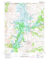
1972 Map of Copan
USGS Topo · Published 1982About this map
Copan and the small settlement of Owen sit at the center of this landscape during a period of significant hydrologic change in Washington County. The northern reaches of Copan Lake dominate the terrain, with blue hatching indicating areas subject to controlled inundation. The Little Caney River meanders through this changing basin, joined by tributaries like Cotton Creek and Pooler Creek.
Find a feature on this map
24 named features on this map. Tap any name to fly to it.
Don’t see what you’re looking for? This feature index may not catch every label — zoom into the map to look around manually.
Map Details
Editions of this 1972 Copan Map
2 editions found
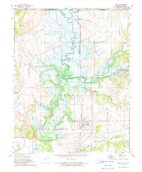
Other maps of this area

1885 · Sedan
USGS Topo · 1:125,000

1886 · Independence
USGS Topo · 1:125,000

1889 · Sedan
USGS Topo · 1:125,000

1894 · Independence
USGS Topo · 1:125,000

1901 · Nowata
USGS Topo · 1:125,000

1905 · Independence
USGS Topo · 1:125,000

1909 · Pawhuska
USGS Topo · 1:125,000

1910 · Pawhuska
USGS Topo · 1:125,000

1914 · Nowata
USGS Topo · 1:125,000

1947 · Joplin
USGS Topo · 1:250,000