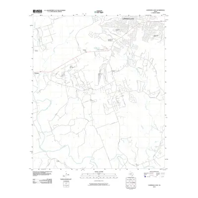
2010 Map of Copperas Cove
USGS Topo · Published 2010About this map
Copperas Cove serves as the primary hub of this landscape, situated near the intersection of several significant natural landmarks. The historical significance of the area is anchored by the Copperas Cove Stagestop and Post Office, while the surrounding terrain is defined by dramatic elevations such as Taylor Mountain, Copperas Point, and Rattlesnake Point. The local geography is further shaped by the passage through Ogletree Gap and Starkie Gap.
Find a feature on this map
66 named features on this map. Tap any name to fly to it.
Don’t see what you’re looking for? This feature index may not catch every label — zoom into the map to look around manually.
Map Details
Editions of this 2010 Copperas Cove Map
This is the sole edition of this map. No revisions or reprints were ever made.
Other maps of this area

1887 · Lampasas
USGS Topo · 1:125,000

1887 · Burnet
USGS Topo · 1:125,000

1893 · Georgetown
USGS Topo · 1:125,000

1893 · Burnet
USGS Topo · 1:125,000

1894 · Lampasas
USGS Topo · 1:125,000

1894 · Gatesville
USGS Topo · 1:125,000

1903 · Burnet
USGS Topo · 1:125,000

1909 · Burnet
USGS Topo · 1:125,000

1947 · Fort Hood
USGS Topo · 1:62,500

1947 · Fort Hood
USGS Topo · 1:24,000