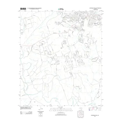
2012 Map of Copperas Cove
USGS Topo · Published 2012About this map
Copperas Cove serves as the primary urban hub in this central Texas landscape, characterized by the winding path of the Lampasas River and its varied tributaries like Binnion Cr and Clear Cr. The topography is defined by notable elevations and passes such as Taylor Mtn, Ogletree Gap, and Starkie Gap, which have historically dictated the placement of roads and settlements. This survey provides significant genealogical value through the documentation of numerous family and community burial grounds, including Kempner Cem, Browning Cem, Smith Cem, and Ethridge Cem. These sites, alongside landmarks like Rattlesnake Point, offer a clear picture of the rural land use and historical occupation patterns that persist outside the expanding residential streets of the city. The network of county roads, such as Co RD-3300 and Big Divide RD, illustrates the transition from the concentrated grid of the town center to the more dispersed agricultural and ranching parcels of the surrounding terrain.
Find a feature on this map
214 named features on this map. Tap any name to fly to it.
Don’t see what you’re looking for? This feature index may not catch every label — zoom into the map to look around manually.
Map Details
Editions of this 2012 Copperas Cove Map
This is the sole edition of this map. No revisions or reprints were ever made.
Other maps of this area

1887 · Lampasas
USGS Topo · 1:125,000

1887 · Burnet
USGS Topo · 1:125,000

1893 · Georgetown
USGS Topo · 1:125,000

1893 · Burnet
USGS Topo · 1:125,000

1894 · Lampasas
USGS Topo · 1:125,000

1894 · Gatesville
USGS Topo · 1:125,000

1903 · Burnet
USGS Topo · 1:125,000

1909 · Burnet
USGS Topo · 1:125,000

1947 · Fort Hood
USGS Topo · 1:62,500

1947 · Fort Hood
USGS Topo · 1:24,000