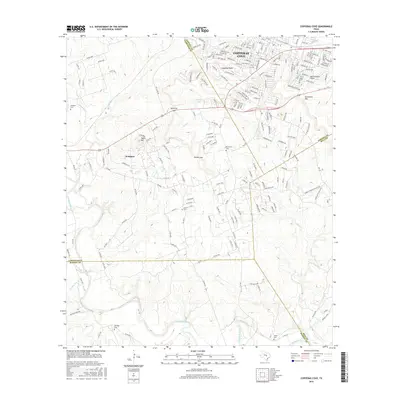
2016 Map of Copperas Cove
USGS Topo · Published 2016About this map
Copperas Cove sits at the intersection of three counties in Central Texas, where the terrain transitions from the hills of Sevenmile Mtn and Taylor Mtn toward the Lampasas River valley. This 2016 survey highlights the area's growth along the US Highway 190 corridor, connecting the expanding urban center of Copperas Cove with the neighboring community of Kempner. The landscape is defined by its gaps and points, such as Ogletree Gap and Starkie Gap, which historically channeled movement through this rugged portion of the Edwards Plateau. Genealogists will find several rural burial grounds preserved across the landscape, including Smith Cem and Ethridge Cem, while the southern reaches of the map track the winding course of the Lampasas River and its tributaries like Burnet Br.
Find a feature on this map
32 named features on this map. Tap any name to fly to it.
Don’t see what you’re looking for? This feature index may not catch every label — zoom into the map to look around manually.
Map Details
Editions of this 2016 Copperas Cove Map
This is the sole edition of this map. No revisions or reprints were ever made.
Other maps of this area

1887 · Lampasas
USGS Topo · 1:125,000

1887 · Burnet
USGS Topo · 1:125,000

1893 · Georgetown
USGS Topo · 1:125,000

1893 · Burnet
USGS Topo · 1:125,000

1894 · Lampasas
USGS Topo · 1:125,000

1894 · Gatesville
USGS Topo · 1:125,000

1903 · Burnet
USGS Topo · 1:125,000

1909 · Burnet
USGS Topo · 1:125,000

1947 · Fort Hood
USGS Topo · 1:62,500

1947 · Fort Hood
USGS Topo · 1:24,000