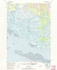
1951 Map of Cordova B-4
USGS Topo · Published 1971About this map
McKinley Peak stands above a complex hydraulic landscape where the Copper River meets the sea in the early 1950s. The region is defined by the shifting braids of the Copper River delta, featuring an intricate web of waterways such as Pete Dahl Slough and Alaganik Slough that carve through the marshes of the Chugach National Forest. Transport into this water-dominated environment is anchored by the Cordova Airport and the Copper River Highway, which parallels the coast toward the settlement of Alaganik. Local history is marked by small-scale industrial and community footprints, including a Mine near McKinley Lake and a Cem near the Alaganik Road, signaling the persistence of activity in a landscape of tidal flats and barrier features like Grass Island Bar and Kokinhenik Bar.
Find a feature on this map
31 named features on this map. Tap any name to fly to it.
Don’t see what you’re looking for? This feature index may not catch every label — zoom into the map to look around manually.
Map Details
Editions of this 1951 Cordova B-4 Map
3 editions found
Other maps of this area

1948 · Cordova
USGS Topo · 1:250,000

1950 · Cordova C-4
USGS Topo · 1:63,360

1951 · Cordova
USGS Topo · 1:250,000

1951 · Cordova B-4
USGS Topo · 1:63,360

1951 · Cordova C-5
USGS Topo · 1:63,360

1951 · Cordova B-5
USGS Topo · 1:63,360

1951 · Cordova C-3
USGS Topo · 1:63,360

1952 · Cordova B-3
USGS Topo · 1:63,360

1953 · Cordova B-5
USGS Topo · 1:63,360

1953 · Cordova C-3
USGS Topo · 1:63,360