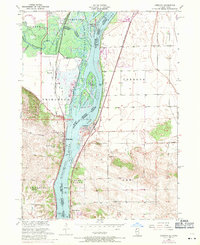
1953 Map of Cordova
USGS Topo · Published 1971About this map
Cordova and Princeton face one another across the Mississippi River, marking a point where the wide waterway is split by the Cordova Slough and protected by the Upper Mississippi River Wild Life and Fish Refuge. The river's role as a vital industrial and transit artery is clear, with the Davenport Rock Island and Northwestern railroad tracking the shoreline. To the north, the Wapsipinicon River joins the system near Folletts, creating a landscape of backwaters and islands like Adams Island.
Find a feature on this map
38 named features on this map. Tap any name to fly to it.
Don’t see what you’re looking for? This feature index may not catch every label — zoom into the map to look around manually.
Map Details
Editions of this 1953 Cordova Map
3 editions found
Other maps of this area

1891 · Clinton
USGS Topo · 1:62,500

1892 · Goose Lake
USGS Topo · 1:62,500

1892 · Leclaire
USGS Topo · 1:62,500

1893 · Leclaire
USGS Topo · 1:62,500

1894 · Goose Lake
USGS Topo · 1:62,500

1894 · Clinton
USGS Topo · 1:62,500

1899 · Clinton
USGS Topo · 1:125,000

1949 · Silvis
USGS Topo · 1:24,000

1949 · Port Byron
USGS Topo · 1:24,000

1950 · Port Byron
USGS Topo · 1:24,000