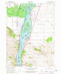
1953 Map of Cordova
USGS Topo · Published 1977About this map
The Mississippi River dominates this landscape where Illinois and Iowa meet, shaping the development of the riverfront towns Cordova and Port Byron. Much of the riparian environment is preserved within the Upper Mississippi River Wild Life and Fish Refuge, characterized by a complex network of side channels like Cordova Slough and sediment-rich landforms such as Adams Island. The river serves as a major transportation artery, marked by navigational aids including Mile 508 and Mile 500.
Find a feature on this map
47 named features on this map. Tap any name to fly to it.
Don’t see what you’re looking for? This feature index may not catch every label — zoom into the map to look around manually.
Map Details
Editions of this 1953 Cordova Map
3 editions found
Other maps of this area

1891 · Clinton
USGS Topo · 1:62,500

1892 · Goose Lake
USGS Topo · 1:62,500

1892 · Leclaire
USGS Topo · 1:62,500

1893 · Leclaire
USGS Topo · 1:62,500

1894 · Goose Lake
USGS Topo · 1:62,500

1894 · Clinton
USGS Topo · 1:62,500

1899 · Clinton
USGS Topo · 1:125,000

1949 · Silvis
USGS Topo · 1:24,000

1949 · Port Byron
USGS Topo · 1:24,000

1950 · Port Byron
USGS Topo · 1:24,000