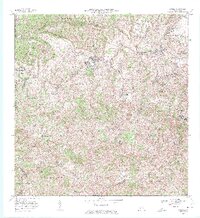
1972 Map of Corozal
USGS Topo · Published 1974About this map
Corozal stands as the central hub of this inland landscape, anchored by the Iglesia de la Inmaculada Concepción and the Parque Atlético. The 1972 survey captures a transition in the local infrastructure, documenting the Planta de Tratamiento de Aguas Negras and the Escuela Vocacional Dr José Padín. The surrounding barrios, including Pueblo, Palmarejo, and Cienegueta, are meticulously mapped with their respective schools and small named settlements like Ramon Pabón and Berio.
Find a feature on this map
60 named features on this map. Tap any name to fly to it.
Don’t see what you’re looking for? This feature index may not catch every label — zoom into the map to look around manually.
Map Details
Editions of this 1972 Corozal Map
3 editions found
Other maps of this area

1940 · Vega Alta
USGS Topo · 1:30,000

1941 · Bayamon
USGS Topo · 1:30,000

1942 · Manati
USGS Topo · 1:30,000

1946 · Corozal
USGS Topo · 1:30,000

1946 · Barranquitas
USGS Topo · 1:30,000

1946 · Ciales
USGS Topo · 1:30,000

1946 · Vega Alta
USGS Topo · 1:30,000

1946 · Comerio
USGS Topo · 1:30,000

1946 · Naranjito
USGS Topo · 1:30,000

1946 · Manati
USGS Topo · 1:30,000
Featured Places
- Corozal
- Los López, Naranjito
- Los Pelusa, Naranjito
- Benito Nieves (Los Quiles), Naranjito
- Comunidad Santa Teresita, Naranjito