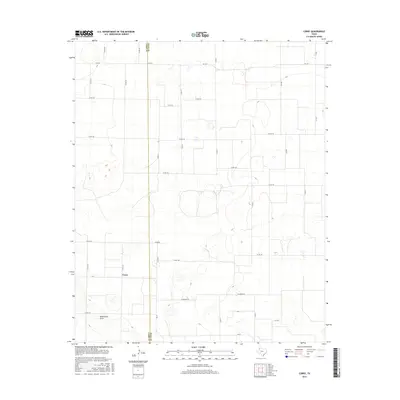
2016 Map of Corry
USGS Topo · Published 2016About this map
The settlement of Corry sits at a crossroads of farm-to-market routes on the High Plains of the Texas Panhandle. This mid-2010s survey illustrates a landscape defined by industrial-scale agriculture and an extensive grid of section-line roads, including W Grande Rd and Elm Rd. The topography is subtly marked by the winding path of Blackwater Draw, a shallow drainage system that cuts across the western portion of the quadrangle. The map also delineates the jurisdictional boundary between Lamb Co and Hale Co, providing a clear record of local geography where these two counties meet. Transportation is anchored by state-maintained corridors like FM 37 and FM 1071, which connect the isolated farmsteads and agricultural plots that dominate the terrain.
Find a feature on this map
28 named features on this map. Tap any name to fly to it.
Don’t see what you’re looking for? This feature index may not catch every label — zoom into the map to look around manually.
Map Details
Editions of this 2016 Corry Map
This is the sole edition of this map. No revisions or reprints were ever made.
Other maps of this area

1954 · Lubbock
USGS Topo · 1:250,000

1954 · Plainview
USGS Topo · 1:250,000

1954 · Clovis
USGS Topo · 1:250,000

1954 · Brownfield
USGS Topo · 1:250,000

1957 · Anton
USGS Topo · 1:62,500

1957 · Abernathy
USGS Topo · 1:62,500

1958 · Brownfield
USGS Topo · 1:250,000

1958 · Clovis
USGS Topo · 1:250,000

1958 · Plainview
USGS Topo · 1:250,000

1962 · Brownfield
USGS Topo · 1:250,000