
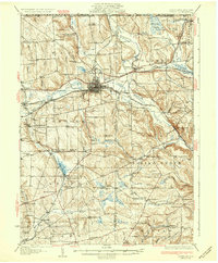
1932 Map of Corry
USGS Topo · Published 1932About this map
Corry serves as the industrial and transportation hub of this 1932 survey, situated at the busy junction of the Pennsylvania RR and the Erie RR. The map illustrates a landscape shaped by these rail corridors and the Roosevelt Highway, which connect the manufacturing center to smaller outlying communities like Spartansburg and Elgin. The surrounding rural townships are densely populated with family-named landmarks and local institutions, ranging from Scotia Ch in the north to the White Chapel near the southern border.
Find a feature on this map
111 named features on this map. Tap any name to fly to it.
Don’t see what you’re looking for? This feature index may not catch every label — zoom into the map to look around manually.
Map Details
Editions of this 1932 Corry Map
3 editions found
Other maps of this area

1904 · Chautaqua
USGS Topo · 1:62,500

1905 · Clymer
USGS Topo · 1:62,500

1913 · North East
USGS Topo · 1:62,500

1915 · North East
USGS Topo · 1:62,500

1926 · Youngsville
USGS Topo · 1:62,500

1927 · Townville
USGS Topo · 1:48,000

1927 · Tidioute
USGS Topo · 1:48,000

1927 · Titusville
USGS Topo · 1:62,500

1929 · Corry
USGS Topo · 1:48,000

1929 · Youngsville
USGS Topo · 1:62,500