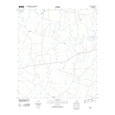
2010 Map of Cost
USGS Topo · Published 2010About this map
The Guadalupe River meanders through this landscape, defining the character of the small communities of Monthalia, Cost, and Wrightsboro. The river's flow is managed by the Lake Gonzales Dam and the M A Wade Dam, creating Lake Gonzales in the northwestern reach. This rural pocket of Gonzales County is marked by a network of drainage systems including Cottonwood Creek, Five Mile Creek, and Brushy Creek, which carve through the terrain near landmarks like Watson Hill and Stevens Hill. Family and community history is preserved at the Pecan Branch Cemetery, Storey Cemetery, and Oso Cemetery. The infrastructure of the era is represented by a dense grid of farm-to-market and county roads, such as FM 466 and State Spur 95, which connect these agricultural outposts to the surrounding region.
Find a feature on this map
56 named features on this map. Tap any name to fly to it.
Don’t see what you’re looking for? This feature index may not catch every label — zoom into the map to look around manually.
Map Details
Editions of this 2010 Cost Map
This is the sole edition of this map. No revisions or reprints were ever made.
Other maps of this area

1901 · Flatonia
USGS Topo · 1:125,000

1911 · San Marcos
USGS Topo · 1:125,000

1919 · San Marcos
USGS Topo · 1:125,000

1920 · Smiley
USGS Topo · 1:125,000

1925 · San Marcos 4-c
USGS Topo · 1:48,000

1929 · Luling
USGS Topo · 1:62,500

1953 · Seguin
USGS Topo · 1:250,000

1958 · Seguin
USGS Topo · 1:250,000

1959 · Ottine
USGS Topo · 1:24,000

1959 · Cost
USGS Topo · 1:24,000