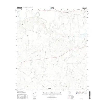
2016 Map of Cost
USGS Topo · Published 2016About this map
The Guadalupe River meanders through this portion of Gonzales County, carving a winding path between the small agricultural communities of Monthalia and Cost. This 2016 survey illustrates the persistent rural character of the region, where family history and land use are etched into the landscape through features like Watson Hill and Stevens Hill. Researchers can identify several localized burial grounds, including Oso Cem, Storey Cem, and Pecan Branch Cem, which anchor the surrounding farmsteads. To the south, the settlement of Wrightsboro sits near the confluence of Brushy Cr and other seasonal drainages. The map details a transition from the river bottomlands to the upland pastures, showing the network of county roads like Co RD 143 and FM 466 that connect these historic Texas townships.
Find a feature on this map
62 named features on this map. Tap any name to fly to it.
Don’t see what you’re looking for? This feature index may not catch every label — zoom into the map to look around manually.
Map Details
Editions of this 2016 Cost Map
This is the sole edition of this map. No revisions or reprints were ever made.
Other maps of this area

1901 · Flatonia
USGS Topo · 1:125,000

1911 · San Marcos
USGS Topo · 1:125,000

1919 · San Marcos
USGS Topo · 1:125,000

1920 · Smiley
USGS Topo · 1:125,000

1925 · San Marcos 4-c
USGS Topo · 1:48,000

1929 · Luling
USGS Topo · 1:62,500

1953 · Seguin
USGS Topo · 1:250,000

1958 · Seguin
USGS Topo · 1:250,000

1959 · Ottine
USGS Topo · 1:24,000

1959 · Cost
USGS Topo · 1:24,000