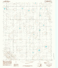
1985 Map of Cotton Center
USGS Topo · Published 1985About this map
Cotton Center anchors this mid-1980s survey of the High Plains, characterized by a dense network of water wells that speak to the intense agricultural development of the Texas Panhandle. The landscape is defined by its subtle drainage patterns, most notably the winding paths of Crawfish Draw in the north and Blackwater Draw to the southwest. These ephemeral stream beds are the primary topographical features in an otherwise meticulously partitioned landscape of section lines and access roads. Infrastructure like the Sub-Station and a prominent Radio Tower serve the small community, while the staggering number of points marked as Well reflects the critical reliance on groundwater to sustain the region's cotton and grain production during this era.
Find a feature on this map
6 named features on this map. Tap any name to fly to it.
Don’t see what you’re looking for? This feature index may not catch every label — zoom into the map to look around manually.
Map Details
Editions of this 1985 Cotton Center Map
This is the sole edition of this map. No revisions or reprints were ever made.
Other maps of this area

1954 · Lubbock
USGS Topo · 1:250,000

1954 · Plainview
USGS Topo · 1:250,000

1954 · Clovis
USGS Topo · 1:250,000

1954 · Brownfield
USGS Topo · 1:250,000

1957 · Anton
USGS Topo · 1:62,500

1957 · Abernathy
USGS Topo · 1:62,500

1958 · Brownfield
USGS Topo · 1:250,000

1958 · Clovis
USGS Topo · 1:250,000

1958 · Plainview
USGS Topo · 1:250,000

1962 · Brownfield
USGS Topo · 1:250,000