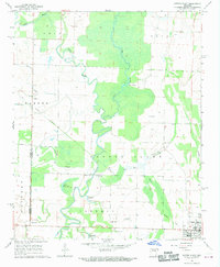
1968 Map of Cotton Plant
USGS Topo · Published 1970About this map
Cotton Plant stands as the primary hub in this late-1960s landscape, where the Prairie Co Woodruff Co line divides the alluvial plains. The region is defined by the winding course of the Cache River Bayou, which creates a complex network of wetlands like Gum Flat and Little Clear Lake. This environment shaped early settlement patterns, leaving behind family-named sites such as James Ferry and small communities like Maberry and Little Dixie.
Find a feature on this map
31 named features on this map. Tap any name to fly to it.
Don’t see what you’re looking for? This feature index may not catch every label — zoom into the map to look around manually.
Map Details
Editions of this 1968 Cotton Plant Map
3 editions found
Other maps of this area

1935 · Gregory
USGS Topo · 1:62,500

1939 · Hunter
USGS Topo · 1:62,500

1940 · Brinkley
USGS Topo · 1:62,500

1941 · De Valls Bluff
USGS Topo · 1:62,500

1948 · Helena
USGS Topo · 1:250,000

1950 · Helena
USGS Topo · 1:250,000

1953 · Memphis
USGS Topo · 1:250,000

1955 · Helena
USGS Topo · 1:250,000

1956 · Memphis
USGS Topo · 1:250,000

1956 · Hunter
USGS Topo · 1:62,500