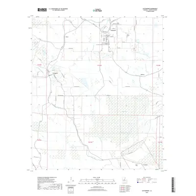
2018 Map of Cottonport
USGS Topo · Published 2018About this map
Cottonport serves as the focal point of this Avoyelles Parish landscape, where the street grid is dense with local landmarks such as the Central Louisiana Technical Community College Cottonport Campus and Saint Anthony Cem. The surrounding territory is defined by a complex network of waterways, including the winding Bayou Rouge and Indian Bayou, which feed into numerous wetlands and distinctive water bodies like Jews-harp Lake and Boggy Lake.
Find a feature on this map
70 named features on this map. Tap any name to fly to it.
Don’t see what you’re looking for? This feature index may not catch every label — zoom into the map to look around manually.
Map Details
Editions of this 2018 Cottonport Map
This is the sole edition of this map. No revisions or reprints were ever made.
Other maps of this area

1940 · Marksville
USGS Topo · 1:62,500

1941 · Voorhies
USGS Topo · 1:62,500

1948 · Bunkie
USGS Topo · 1:62,500

1952 · Lake Charles
USGS Topo · 1:250,000

1953 · Alexandria
USGS Topo · 1:250,000

1953 · Natchez
USGS Topo · 1:250,000

1954 · Lake Charles
USGS Topo · 1:250,000

1954 · Baton Rouge
USGS Topo · 1:250,000

1955 · Odenburg
USGS Topo · 1:62,500

1955 · Alexandria
USGS Topo · 1:250,000