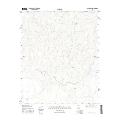
2016 Map of Cottonwood Camp
USGS Topo · Published 2016About this map
Cottonwood Camp serves as a lone named outpost in this high-plains landscape where the Hall and Motley County line bisects the rugged terrain. The geography is defined by a network of seasonal watercourses and drainage systems, most notably the North Pease River and Wind River. Essential for ranching operations in this arid environment, numerous water features such as White Tank, Hughs Tank, and Horseshoe Tank are scattered across the quadrangle. These man-made improvements, alongside named landforms like T Bar Canyon and Poker Canyon, illustrate the infrastructure required to manage livestock in the Texas Panhandle. The map reveals the path of Ranch Road 656 and various county roads including Hall County Road 15, providing a modern view of the transportation network connecting these remote ranchlands and the winding path of Turkey Creek.
Find a feature on this map
19 named features on this map. Tap any name to fly to it.
Don’t see what you’re looking for? This feature index may not catch every label — zoom into the map to look around manually.
Map Details
Editions of this 2016 Cottonwood Camp Map
This is the sole edition of this map. No revisions or reprints were ever made.
Other maps of this area

1954 · Plainview
USGS Topo · 1:250,000

1958 · Plainview
USGS Topo · 1:250,000

1966 · Fields Canyon
USGS Topo · 1:24,000

1967 · North Windmill
USGS Topo · 1:24,000

1967 · Cottonwood Camp
USGS Topo · 1:24,000

1967 · Tampico Siding
USGS Topo · 1:24,000

1967 · Badger Nest Tank
USGS Topo · 1:24,000

1967 · Hornica Creek
USGS Topo · 1:24,000

1967 · Turtle Hole Camp
USGS Topo · 1:24,000

1967 · Northfield
USGS Topo · 1:24,000