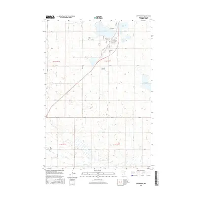
2016 Map of Cottonwood
USGS Topo · Published 2016About this map
Cottonwood sits at the heart of this Lyon County landscape, where the town grid meets the shores of Cottonwood Lake. The town's layout is well-defined by local thoroughfares such as Main St, Front St, and E Prairie St, reflecting its role as a local center of commerce and community. Genealogists will find significant value in the distribution of several burial grounds, including the Cottonwood Cem, Christ Cem, and English Cem near the town site, as well as Saint Clotilde Cem further south. The natural geography is characterized by several distinctive water bodies and drainage systems, most notably Sham Lake, Lady Slipper Lake, and the Lady Shoe Lake Bed. In the southern reaches of the quadrangle, the Redwood River and Threemile Cr carve through the agricultural plains, illustrating the drainage patterns that have historically shaped local land use.
Find a feature on this map
58 named features on this map. Tap any name to fly to it.
Don’t see what you’re looking for? This feature index may not catch every label — zoom into the map to look around manually.
Map Details
Editions of this 2016 Cottonwood Map
This is the sole edition of this map. No revisions or reprints were ever made.
Other maps of this area

1953 · New Ulm
USGS Topo · 1:250,000

1957 · New Ulm
USGS Topo · 1:250,000

1958 · New Ulm
USGS Topo · 1:250,000

1962 · Wood Lake NW
USGS Topo · 1:24,000

1962 · Dudley
USGS Topo · 1:24,000

1962 · Cottonwood
USGS Topo · 1:24,000

1962 · School Grove Lake
USGS Topo · 1:24,000

1962 · Wood Lake
USGS Topo · 1:24,000

1962 · Milroy
USGS Topo · 1:24,000

1963 · Marshall
USGS Topo · 1:24,000