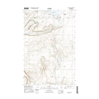
2017 Map of Coulee City
USGS Topo · Published 2017About this map
Coulee City sits at the northern edge of a landscape defined by the Channeled Scablands, where the prehistoric Dry Falls and the carved Upper Grand Coulee meet. This 2017 study illustrates the modern water management system and recreational infrastructure that dominates the terrain, including the southern reaches of Banks Lake and the Bacon Tunnel. The topography is exceptionally detailed, showing the basalt formations and coulees such as Trail Lake Coulee and Hudson Coulee. Scattered settlements like Odair and Bacon are documented alongside natural landmarks including Umatilla Rock and Table Rock. The map also captures the local transportation network, from the Coulee City Airport to the system of county roads including Pinto Ridge Rd NE, providing a clear view of how irrigation and geology have shaped this Grant County corridor.
Find a feature on this map
62 named features on this map. Tap any name to fly to it.
Don’t see what you’re looking for? This feature index may not catch every label — zoom into the map to look around manually.
Map Details
Editions of this 2017 Coulee City Map
This is the sole edition of this map. No revisions or reprints were ever made.
Other maps of this area

1930 · Grand Coulee Sheet 3
USGS Topo · 1:31,680

1953 · Ritzville
USGS Topo · 1:250,000

1956 · Stratford
USGS Topo · 1:24,000

1956 · Wilson Creek NW
USGS Topo · 1:24,000

1956 · Soap Lake
USGS Topo · 1:24,000

1956 · Wilson Creek
USGS Topo · 1:62,500

1959 · Ritzville
USGS Topo · 1:250,000

1965 · Ritzville
USGS Topo · 1:250,000

1965 · St. Andrews
USGS Topo · 1:24,000

1965 · Mold
USGS Topo · 1:24,000