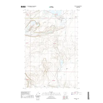
2020 Map of Coulee City
USGS Topo · Published 2020About this map
Coulee City sits at the northern edge of this high-desert landscape where the Grand Coulee widens into a complex network of ancient flood-carved geology. The 2020 geography highlights the critical role of water management in this arid region, featuring the southern extent of Banks Lake and the Main Canal which feeds the Columbia Basin Project. To the south and west, the dramatic terrain of the Sun Lakes-Dry Falls area is revealed, including the towering Umatilla Rock and the dry precipice of Dry Falls. Historical paths like the Caribou Trail and Monument Coulee Trail suggest the long-standing importance of this corridor for passage through the basalt coulees. Small railroad-related settlements and sidings like Odair and Bacon flank the town, connected by the infrastructure of the Bacon Tunnel and rural routes traversing Arbuckle Flats.
Find a feature on this map
65 named features on this map. Tap any name to fly to it.
Don’t see what you’re looking for? This feature index may not catch every label — zoom into the map to look around manually.
Map Details
Editions of this 2020 Coulee City Map
This is the sole edition of this map. No revisions or reprints were ever made.
Other maps of this area

1930 · Grand Coulee Sheet 3
USGS Topo · 1:31,680

1953 · Ritzville
USGS Topo · 1:250,000

1956 · Stratford
USGS Topo · 1:24,000

1956 · Wilson Creek NW
USGS Topo · 1:24,000

1956 · Soap Lake
USGS Topo · 1:24,000

1956 · Wilson Creek
USGS Topo · 1:62,500

1959 · Ritzville
USGS Topo · 1:250,000

1965 · Ritzville
USGS Topo · 1:250,000

1965 · St. Andrews
USGS Topo · 1:24,000

1965 · Mold
USGS Topo · 1:24,000