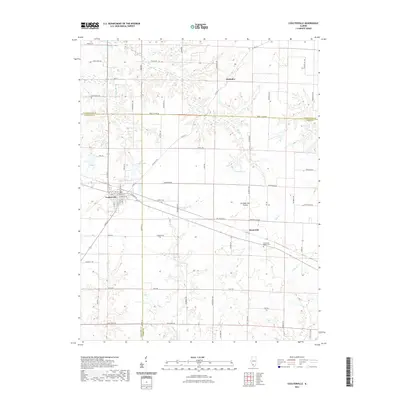
2021 Map of Coulterville
USGS Topo · Published 2021About this map
Coulterville stands as the primary hub at the intersection of local routes in this modern survey of the Illinois interior. The landscape is defined by the agricultural expanses of the Grande Cote Prairie, where the drainage patterns of Mud Cr and the S Fork Mud Cr carve through the terrain. To the east, the settlement of Swanwick anchors a rural corridor that includes the Swanwick Bethel Cem, a site of significant genealogical interest for those tracing family roots in Randolph and Perry counties. Water features like Lake Coulterville and Foertch Pond provide central landmarks within the grid of country roads. Small crossroads like McKinley and the flow of Galum Cr illustrate the persistent rural character of this region, where county lines between Washington, Randolph, and Perry meet amidst a network of family-named roads like Ziegler 11 Rd and Pleasant Hill Rd.
Find a feature on this map
48 named features on this map. Tap any name to fly to it.
Don’t see what you’re looking for? This feature index may not catch every label — zoom into the map to look around manually.
Map Details
Editions of this 2021 Coulterville Map
This is the sole edition of this map. No revisions or reprints were ever made.
Other maps of this area

1910 · Okawville
USGS Topo · 1:62,500

1914 · Coulterville
USGS Topo · 1:62,500

1917 · Coulterville
USGS Topo · 1:62,500

1924 · Pinckneyville
USGS Topo · 1:62,500

1926 · Pinckneyville
USGS Topo · 1:62,500

1931 · Hoyleton
USGS Topo · 1:48,000

1932 · Nashville
USGS Topo · 1:62,500

1936 · Nashville
USGS Topo · 1:62,500

1940 · Okawville
USGS Topo · 1:62,500

1958 · Belleville
USGS Topo · 1:250,000