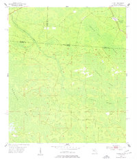
1955 Map of Council
USGS Topo · Published 1977About this map
Pinhook Swamp and Double Run Swamp dominate this low-lying borderland, where the intricate hydrology of the Okefenokee basin crosses between Georgia and Florida. The settlement of Council stands as a primary point of human activity in the northeast, positioned along the Southern railroad line. This rail corridor provided essential access for the timber industry in a landscape defined by expansive wetlands like Sandlin Bay and the winding course of Little Suwannee Creek. The map documents the historic Watson Line, an important surveying landmark that demarcates the state boundary, cutting through the dense interior of these southern swamps during the mid-1950s.
Find a feature on this map
16 named features on this map. Tap any name to fly to it.
Don’t see what you’re looking for? This feature index may not catch every label — zoom into the map to look around manually.
Map Details
Editions of this 1955 Council Map
4 editions found
Other maps of this area

1954 · Valdosta
USGS Topo · 1:250,000

1955 · Council
USGS Topo · 1:24,000

1955 · Fargo SW
USGS Topo · 1:24,000

1956 · Sargent
USGS Topo · 1:24,000

1958 · Valdosta
USGS Topo · 1:250,000

1959 · Valdosta
USGS Topo · 1:250,000

1967 · Strange Island
USGS Topo · 1:24,000

1967 · Sargent
USGS Topo · 1:24,000

1967 · Fargo
USGS Topo · 1:24,000

1968 · Needmore
USGS Topo · 1:24,000