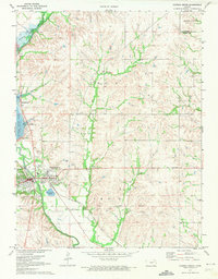
1971 Map of Council Grove
USGS Topo · Published 1974About this map
Council Grove is the focal point of this Kansas landscape, situated at the confluence of the Neosho River and Elm Creek. The map documents a critical moment in the area's geography, showing the expansive Council Grove Lake formed behind the Council Grove Dam. A notable historical artifact is the Old Indian Treaty Boundary cutting across the southern portion of the quadrangle, preserving the lines of earlier territorial agreements on the 1970s landscape. Industrial and social life is marked by numerous quarries, the Fairground, and a Drive-in Theater on the outskirts of town. Transportation patterns are anchored by the Missouri Pacific Railroad Grade, which follows the river valley near Big John Creek and Munkers Creek, illustrating the intersection of rail infrastructure and the natural drainage basins of Morris County.
Find a feature on this map
31 named features on this map. Tap any name to fly to it.
Don’t see what you’re looking for? This feature index may not catch every label — zoom into the map to look around manually.
Map Details
Editions of this 1971 Council Grove Map
2 editions found
Other maps of this area

1885 · Eskridge
USGS Topo · 1:125,000

1889 · Parkerville
USGS Topo · 1:125,000

1889 · Eskridge
USGS Topo · 1:125,000

1894 · Eskridge
USGS Topo · 1:125,000

1894 · Parkerville
USGS Topo · 1:125,000

1955 · Hutchinson
USGS Topo · 1:250,000

1959 · Hutchinson
USGS Topo · 1:250,000

1971 · Alta Vista SE
USGS Topo · 1:24,000

1971 · Bushong
USGS Topo · 1:24,000

1971 · Alta Vista
USGS Topo · 1:24,000