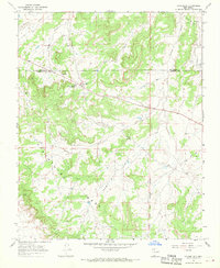
1966 Map of Counselor
USGS Topo · Published 1970About this map
Counselor serves as a central point in this high-desert landscape of northwestern New Mexico, situated near the boundary between Rio Arriba and Sandoval counties. The settlement is defined by the presence of the Brethren Navajo Boarding Sch, indicating the era's institutional footprint within the region. To the east, the Jicarilla Apache Indian Reservation Bdy marks a significant jurisdictional transition across a terrain carved by numerous drainages, including Escrito Canyon, Gallo Canyon, and Vernado Canyon. Industrial activity is evident on the plateau, where the San Juan Basin Gas Field and scattered Oil Wells appear alongside a Pumping Sta. The dominant natural feature is the expansive Snahyel Mesa, which dictates the movement of travel along various Jeep Trails that navigate the ridges and canyon floors.
Find a feature on this map
15 named features on this map. Tap any name to fly to it.
Don’t see what you’re looking for? This feature index may not catch every label — zoom into the map to look around manually.
Map Details
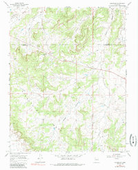
Editions of this 1966 Counselor Map
2 editions found
Other maps of this area

1889 · Largo
USGS Topo · 1:250,000

1895 · Largo
USGS Topo · 1:250,000

1954 · Aztec
USGS Topo · 1:250,000

1958 · Aztec
USGS Topo · 1:250,000

1959 · Nageezi
USGS Topo · 1:62,500

1962 · Aztec
USGS Topo · 1:250,000

1963 · Tayfoya Canyon
USGS Topo · 1:24,000

1963 · Otero Store
USGS Topo · 1:24,000

1965 · Aztec
USGS Topo · 1:250,000
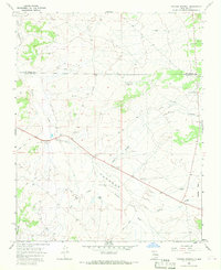
1966 · Tancosa Windmill
USGS Topo · 1:24,000
Featured Places
- Eastern Navajo Agency, NM
- Counselor, Eastern Navajo Agency
- Sandoval County, NM
- Rio Arriba County, NM
- United States