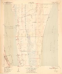
1951 Map of Courtenay
USGS Topo · Published 1951About this map
Merritt Island is defined by a landscape of narrow waterways and coastal settlements in the late 1940s, situated between the Indian River and the Banana River. The interior of the island is bisected by Sykes Creek, creating a complex network of marshes and shorelines that dictated the early growth of communities like Courtenay and Indianola. Local history is anchored by several small country churches and burial grounds, including St Lukes Ch, Mt Zion Ch, and the Bethel Cem. On the mainland across the Intracoastal Waterway, the town of Cocoa serves as a transportation hub along the Florida East Coast railroad. This survey captures the region just before the mid-century expansion of the nearby space center began to fundamentally transform the rural character of the island’s settlements and citrus groves.
Find a feature on this map
28 named features on this map. Tap any name to fly to it.
Don’t see what you’re looking for? This feature index may not catch every label — zoom into the map to look around manually.
Map Details
Editions of this 1951 Courtenay Map
2 editions found
Other maps of this area

1949 · Orsino
USGS Topo · 1:24,000

1949 · False Cape
USGS Topo · 1:24,000

1949 · Titusville
USGS Topo · 1:24,000

1949 · Courtenay
USGS Topo · 1:24,000

1949 · Sharpes
USGS Topo · 1:24,000

1949 · Cocoa
USGS Topo · 1:24,000

1949 · Cocoa Beach
USGS Topo · 1:24,000

1951 · False Cape
USGS Topo · 1:24,000

1951 · Cocoa
USGS Topo · 1:24,000

1951 · Courtenay
USGS Topo · 1:24,000