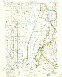
1952 Map of Courtland
USGS Topo · Published 1959About this map
The Sacramento River and its complex network of sloughs define this agricultural landscape in the early 1950s, where river-driven commerce meets a growing inland infrastructure. Settlement patterns follow the natural levees and man-made cuts, with established communities like Clarksburg and Courtland anchoring the riverbanks. The map illustrates a period when the Northern Electric and Southern Pacific railroads provided critical links for the region's agricultural output.
Find a feature on this map
96 named features on this map. Tap any name to fly to it.
Don’t see what you’re looking for? This feature index may not catch every label — zoom into the map to look around manually.
Map Details
Editions of this 1952 Courtland Map
3 editions found
Other maps of this area

1891 · Sacramento
USGS Topo · 1:125,000

1892 · Sacramento
USGS Topo · 1:125,000

1893 · Sacramento
USGS Topo · 1:125,000

1894 · Lodi
USGS Topo · 1:125,000

1902 · Fairoaks
USGS Topo · 1:62,500

1907 · Woodland
USGS Topo · 1:62,500

1907 · Davisville
USGS Topo · 1:62,500

1907 · Antioch
USGS Topo · 1:62,500

1908 · Vacaville
USGS Topo · 1:62,500

1908 · Courtland
USGS Topo · 1:62,500