
1978 Map of Courtois
USGS Topo · Published 1979About this map
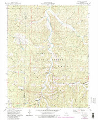
The Mark Twain National Forest dominates this section of the Ozark Plateau, where the winding path of Courtois Creek carves through the terrain of Washington and Crawford Counties. Small rural settlements like Brazil, Courtois, and Quaker are connected by a network of unimproved and light-duty roads that navigate the many hollows, including Boiling Springs Hollow and Walnut Hollow. The map reveals a deeply rooted community structure through its concentration of country churches and burial sites, such as Sugar Grove Ch, Bethel Ch, and the Jinkerson Cem.
Find a feature on this map
44 named features on this map. Tap any name to fly to it.
Don’t see what you’re looking for? This feature index may not catch every label — zoom into the map to look around manually.
Map Details
Editions of this 1978 Courtois Map
3 editions found
Other maps of this area

1906 · Potosi
USGS Topo · 1:62,500

1924 · Edgehill
USGS Topo · 1:62,500

1926 · Edgehill
USGS Topo · 1:62,500

1943 · Berryman
USGS Topo · 1:62,500

1943 · Boss
USGS Topo · 1:62,500

1945 · Berryman
USGS Topo · 1:62,500

1946 · Boss
USGS Topo · 1:62,500

1949 · Rolla
USGS Topo · 1:250,000

1953 · Rolla
USGS Topo · 1:250,000

1954 · Rolla
USGS Topo · 1:250,000