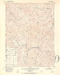
1952 Map of Covelo
USGS Topo · Published 1954About this map
The Round Valley Indian Reservation dominates this mid-century survey of the Mendocino county interior, centered on the settlement of Covelo. The landscape is a complex network of high ridges and deep river canyons, where the Middle Fork Eel River and Black Butte River converge. At the heart of the reservation, local history is marked by the Nomlackee Cem and the Reservation School, while surrounding valley floor life is traced through lanes such as Adobe Lane and Fairbanks Lane.
Find a feature on this map
91 named features on this map. Tap any name to fly to it.
Don’t see what you’re looking for? This feature index may not catch every label — zoom into the map to look around manually.
Map Details
Editions of this 1952 Covelo Map
4 editions found

Other maps of this area

1890 · Red Bluff
USGS Topo · 1:250,000

1894 · Red Bluff
USGS Topo · 1:250,000

1920 · Covelo
USGS Topo · 1:62,500

1921 · Hoaglin
USGS Topo · 1:62,500

1922 · Island Mountain
USGS Topo · 1:62,500

1926 · Covelo
USGS Topo · 1:62,500

1929 · Eden Valley
USGS Topo · 1:62,500

1931 · Hoaglin
USGS Topo · 1:96,000

1935 · Hoaglin
USGS Topo · 1:125,000

1951 · Laytonville
USGS Topo · 1:62,500