
1952 Map of Covelo
USGS Topo · Published 1954About this map
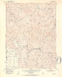
The Round Valley Indian Reservation dominates this mid-century topography, centered on the valley floor where the settlement of Covelo serves as a hub of activity. This 1952 field-checked survey reveals a landscape where the valley's level fields and cattle operations at Bauer Ranch and Capistran Ranch contrast sharply with the surrounding mountains of the Mendocino National Forest. Water is the lifeblood of the region, with Mill Creek and Grist Creek feeding into the Middle Fork Eel River. Evidence of early community infrastructure is found at the Reservation School and the Nomlackie Cem, while the higher elevations are marked by remote outposts like the Osborn Ranger Sta and the winding Travelers Home Trail. The map captures a transition point in Northern California's back country, where established family ranches like the Foster Ranch were still the primary landmarks in a world defined by peaks like Leech Lake Mtn and Castle Peak.
Find a feature on this map
94 named features on this map. Tap any name to fly to it.
Don’t see what you’re looking for? This feature index may not catch every label — zoom into the map to look around manually.
Map Details
Editions of this 1952 Covelo Map
4 editions found
Other maps of this area

1890 · Red Bluff
USGS Topo · 1:250,000

1894 · Red Bluff
USGS Topo · 1:250,000

1920 · Covelo
USGS Topo · 1:62,500

1921 · Hoaglin
USGS Topo · 1:62,500

1922 · Island Mountain
USGS Topo · 1:62,500

1926 · Covelo
USGS Topo · 1:62,500

1929 · Eden Valley
USGS Topo · 1:62,500

1931 · Hoaglin
USGS Topo · 1:96,000

1935 · Hoaglin
USGS Topo · 1:125,000

1951 · Laytonville
USGS Topo · 1:62,500