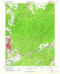
1962 Map of Covington
USGS Topo · Published 1964About this map
Covington serves as the industrial and civic anchor of this 1962 survey, situated at the confluence of Jackson River and Dunlap Creek. The city's residential and industrial footprint extends into neighborhoods like Rayon Terrace, Edgemont, and Parrish Court, while the Chesapeake And Ohio railroad tracks carve a path through the valley. The surrounding landscape is defined by the steep slopes of Warm Springs Mountain and Horse Mountain, much of which is protected within the George Washington National Forest.
Find a feature on this map
67 named features on this map. Tap any name to fly to it.
Don’t see what you’re looking for? This feature index may not catch every label — zoom into the map to look around manually.
Map Details
Editions of this 1962 Covington Map
4 editions found
Other maps of this area

1887 · Lewisburg
USGS Topo · 1:125,000

1891 · Lewisburg
USGS Topo · 1:125,000

1894 · Natural Bridge
USGS Topo · 1:125,000

1913 · Eagle Rock
USGS Topo · 1:48,000

1915 · Eagle Rock
USGS Topo · 1:62,500

1921 · Callaghan
USGS Topo · 1:48,000

1923 · Callaghan
USGS Topo · 1:62,500

1929 · Falling Spring
USGS Topo · 1:24,000

1931 · Healing Springs
USGS Topo · 1:24,000

1932 · Falling Spring
USGS Topo · 1:31,680