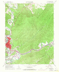
1962 Map of Covington
USGS Topo · Published 1971About this map
The Covington industrial landscape is defined by its position along the Jackson River, where 1960s developments include Industrial Waste Ponds, a Filtration Plant, and a local Airport. This era of the city's growth is juxtaposed against the older mountainous extraction economy, most notably the Rich Patch Mines at the foot of Horse Mountain. The heavy transit corridor of the Chesapeake and Ohio railroad ties the settlement of Lowmoor to the city center, passing by established neighborhoods like Rayon Terrace and Mallow. Social and civic life is anchored by institutions such as Alleghany High Sch and Cedar Hill Cemetery. Beyond the urban core, the terrain rises into the George Washington National Forest, where landmarks like Falling Spring Falls and the Alleghany Country Club show the area's transition into recreational land use.
Find a feature on this map
65 named features on this map. Tap any name to fly to it.
Don’t see what you’re looking for? This feature index may not catch every label — zoom into the map to look around manually.
Map Details
Editions of this 1962 Covington Map
4 editions found
Other maps of this area

1887 · Lewisburg
USGS Topo · 1:125,000

1891 · Lewisburg
USGS Topo · 1:125,000

1894 · Natural Bridge
USGS Topo · 1:125,000

1913 · Eagle Rock
USGS Topo · 1:48,000

1915 · Eagle Rock
USGS Topo · 1:62,500

1921 · Callaghan
USGS Topo · 1:48,000

1923 · Callaghan
USGS Topo · 1:62,500

1929 · Falling Spring
USGS Topo · 1:24,000

1931 · Healing Springs
USGS Topo · 1:24,000

1932 · Falling Spring
USGS Topo · 1:31,680