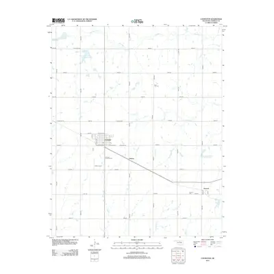
2012 Map of Covington
USGS Topo · Published 2012About this map
Covington serves as the primary hub of this Garfield County landscape, characterized by a grid of agricultural section lines and a series of water management sites. The town’s layout is clearly defined by streets such as W Washington St and E Skeleton Rd, with the Covington Community Cem located just to the south. The surrounding terrain is defined by the drainage of Black Bear Cr and its tributaries, including Crow Cr and Panther Cr.
Find a feature on this map
41 named features on this map. Tap any name to fly to it.
Don’t see what you’re looking for? This feature index may not catch every label — zoom into the map to look around manually.
Map Details
Editions of this 2012 Covington Map
This is the sole edition of this map. No revisions or reprints were ever made.
Other maps of this area

1893 · Mulhall
USGS Topo · 1:62,500

1893 · Lovell
USGS Topo · 1:62,500

1955 · Enid
USGS Topo · 1:250,000

1956 · Garber
USGS Topo · 1:62,500

1958 · Enid
USGS Topo · 1:250,000

1972 · Perry NW
USGS Topo · 1:24,000

1972 · Lucien
USGS Topo · 1:24,000

1974 · Marshall West
USGS Topo · 1:24,000

1974 · Marshall East
USGS Topo · 1:24,000
1974 · Orlando West
USGS Topo · 1:24,000