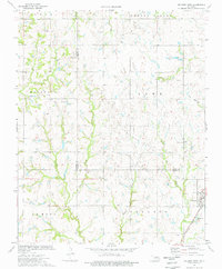
1974 Map of Orlando West
USGS Topo · Published 1977About this map
The boundary between Noble and Logan counties centers this mid-1970s landscape, where the settlement of Orlando sits at the intersection of rural agriculture and heavy industry. The land is marked by an extensive network of petroleum extraction, including a prominent Oil Field and numerous gas and oil wells. Grounding the community's history are several established landmarks, from the Potter Ch to a series of rural burial grounds like German Cem and Mt Zion Cem. Transportation and infrastructure are defined by the Atchison Topeka and Santa Fe railroad, which parallels the county line near the Sewage Disp Ponds. Waterways such as Beaver Creek and Warren Cr drain the terrain, providing natural landmarks among the industrial development of the Marshall, Lowe, and Gas Field regions.
Find a feature on this map
33 named features on this map. Tap any name to fly to it.
Don’t see what you’re looking for? This feature index may not catch every label — zoom into the map to look around manually.
Map Details
Editions of this 1974 Orlando West Map
This is the sole edition of this map. No revisions or reprints were ever made.
Other maps of this area

1893 · Mulhall
USGS Topo · 1:62,500

1893 · Lovell
USGS Topo · 1:62,500

1955 · Enid
USGS Topo · 1:250,000

1956 · Garber
USGS Topo · 1:62,500

1958 · Enid
USGS Topo · 1:250,000

1972 · Perry
USGS Topo · 1:24,000

1972 · Lucien
USGS Topo · 1:24,000
1974 · Mulhall
USGS Topo · 1:24,000
1974 · Orlando East
USGS Topo · 1:24,000

1974 · Marshall East
USGS Topo · 1:24,000