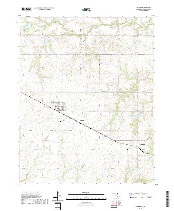
2022 Map of Covington
USGS Topo · Published 2022About this map
Covington stands as the primary hub of this north-central Oklahoma agricultural landscape, with its residential streets including Washington St and Madison St organized in a traditional grid. The surrounding Garfield County terrain is defined by a dense network of sectional roads and the winding paths of Black Bear Cr and Panther Cr. Rural life and local history are anchored by several dedicated grounds, such as the Saint John Cem to the north and the Covington Community Cem just east of town. To the southeast, the small settlement of Hayward marks a crossroads near the Hayward Cem and the waters of Hayward Lake. The map reveals a land heavily managed for water resources, most notably by the Upper Black Bear Cr Site 42 Reservoir, reflecting the region's reliance on creek-fed impoundments for its farming and ranching economy.
Find a feature on this map
47 named features on this map. Tap any name to fly to it.
Don’t see what you’re looking for? This feature index may not catch every label — zoom into the map to look around manually.
Map Details
Editions of this 2022 Covington Map
This is the sole edition of this map. No revisions or reprints were ever made.
Other maps of this area

1893 · Mulhall
USGS Topo · 1:62,500

1893 · Lovell
USGS Topo · 1:62,500

1955 · Enid
USGS Topo · 1:250,000

1956 · Garber
USGS Topo · 1:62,500

1958 · Enid
USGS Topo · 1:250,000

1972 · Perry NW
USGS Topo · 1:24,000

1972 · Lucien
USGS Topo · 1:24,000

1974 · Marshall West
USGS Topo · 1:24,000

1974 · Marshall East
USGS Topo · 1:24,000
1974 · Orlando West
USGS Topo · 1:24,000