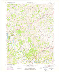
1952 Map of Cowan
USGS Topo · Published 1978About this map
The Licking River carves a deep path through the borders of Fleming, Nicholas, and Robertson counties, anchoring a landscape defined by 18th-century conflict and 19th-century transit. Blue Licks Battlefield State Park marks the site of one of the final battles of the American Revolutionary War, while the nearby Blue Licks Spr indicates the saline deposits that once drew both wildlife and frontier hunters to these banks.
Find a feature on this map
32 named features on this map. Tap any name to fly to it.
Don’t see what you’re looking for? This feature index may not catch every label — zoom into the map to look around manually.
Map Details
Editions of this 1952 Cowan Map
3 editions found
Other maps of this area

1915 · Maysville
USGS Topo · 1:62,500

1919 · Maysville
USGS Topo · 1:62,500

1952 · Cowan
USGS Topo · 1:24,000

1952 · Sherburne
USGS Topo · 1:24,000

1952 · Elizaville
USGS Topo · 1:24,000

1952 · Sardis
USGS Topo · 1:24,000

1952 · Mount Olivet
USGS Topo · 1:24,000

1952 · Piqua
USGS Topo · 1:24,000
1952 · Mays Lick
USGS Topo · 1:24,000

1953 · Carlisle
USGS Topo · 1:24,000