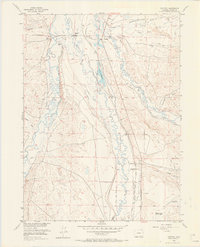
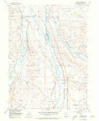
1956 Map of Cowdrey
USGS Topo · Published 1965About this map
The Michigan River and the Canadian River converge in this high-altitude basin of Jackson County, where a complex network of irrigation ditches supported early twentieth-century ranching operations. The tiny settlement of Cowdrey serves as a central hub, flanked by family holdings such as the Carlstrom Ranch, Hanson Ranch, and Brownlee Ranch. This landscape reflects a transitional economy, balancing traditional cattle ranching with emerging energy interests, evidenced by the Oil Field and Oil Well markers near North McCallum. The Pacific Union railroad line cuts through the center of the sheet, providing a vital link for the region's resources. Traces of historical water management are everywhere, from the Cumberland Ditch to the Carlstrom Reservoir, alongside several segments labeled as Abandoned Ditch, marking the shifting priorities of high-country land use.
Find a feature on this map
55 named features on this map. Tap any name to fly to it.
Don’t see what you’re looking for? This feature index may not catch every label — zoom into the map to look around manually.
Map Details
Editions of this 1956 Cowdrey Map
5 editions found
Other maps of this area

1950 · Northgate
USGS Topo · 1:24,000

1950 · Kings Canyon
USGS Topo · 1:24,000

1952 · Northgate
USGS Topo · 1:24,000

1952 · Kings Canyon
USGS Topo · 1:24,000

1954 · Craig
USGS Topo · 1:250,000

1955 · Independence Mountain
USGS Topo · 1:24,000

1955 · Lake John
USGS Topo · 1:24,000

1955 · Eagle Hill
USGS Topo · 1:24,000

1955 · Delaney Butte
USGS Topo · 1:24,000

1955 · Gould NW
USGS Topo · 1:24,000