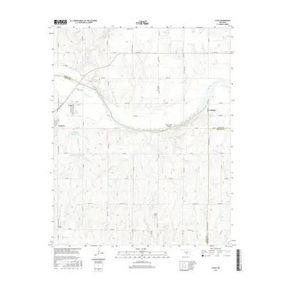
2016 Map of Coyle
USGS Topo · Published 2016About this map
Cimarron River bends sharply through the heart of this landscape, carving the distinctive Horse Thief Canyon along its northern bank. This central Oklahoma terrain is a intersection of three counties, where the borders of Logan, Payne, and Lincoln meet. The town of Coyle sits near the western bend of the river, while the community of Langston is established further south along the western edge.
Find a feature on this map
59 named features on this map. Tap any name to fly to it.
Don’t see what you’re looking for? This feature index may not catch every label — zoom into the map to look around manually.
Map Details
Editions of this 2016 Coyle Map
This is the sole edition of this map. No revisions or reprints were ever made.
Other maps of this area

1892 · Guthrie
USGS Topo · 1:62,500

1893 · Mulhall
USGS Topo · 1:62,500

1893 · Stillwater
USGS Topo · 1:62,500

1909 · Perkins
USGS Topo · 1:62,500

1954 · Oklahoma City
USGS Topo · 1:250,000

1955 · Enid
USGS Topo · 1:250,000

1957 · Oklahoma City
USGS Topo · 1:250,000

1958 · Enid
USGS Topo · 1:250,000

1963 · Oklahoma City
USGS Topo · 1:250,000
1967 · Stillwater South
USGS Topo · 1:24,000