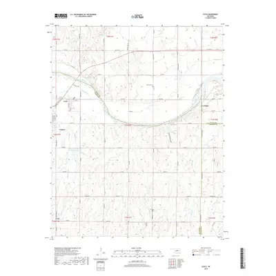
2018 Map of Coyle
USGS Topo · Published 2018About this map
Langston and Coyle anchor this portion of the Oklahoma landscape, where the Cimarron River carves a wide arc through the intersection of Logan, Payne, and Lincoln counties. The terrain is defined by its drainages, including the rugged Horse Thief Canyon and the confluence of Fitzgerald Cr and Soldier Cr, the latter of which feeds the Fitzgerald-Soldier Cr-Site 5 Reservoir. This map documents a region rooted in its rural network, where the Indian Meridian serves as a primary surveying baseline for the surrounding townships.
Find a feature on this map
67 named features on this map. Tap any name to fly to it.
Don’t see what you’re looking for? This feature index may not catch every label — zoom into the map to look around manually.
Map Details
Editions of this 2018 Coyle Map
This is the sole edition of this map. No revisions or reprints were ever made.
Other maps of this area

1892 · Guthrie
USGS Topo · 1:62,500

1893 · Mulhall
USGS Topo · 1:62,500

1893 · Stillwater
USGS Topo · 1:62,500

1909 · Perkins
USGS Topo · 1:62,500

1954 · Oklahoma City
USGS Topo · 1:250,000

1955 · Enid
USGS Topo · 1:250,000

1957 · Oklahoma City
USGS Topo · 1:250,000

1958 · Enid
USGS Topo · 1:250,000

1963 · Oklahoma City
USGS Topo · 1:250,000
1967 · Stillwater South
USGS Topo · 1:24,000