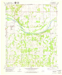
1978 Map of Coyle
USGS Topo · Published 1979About this map
The Cimarron River carves a wide arc through this Oklahoma landscape, defining the transition between North Cimarron and South Cimarron. In the late 1970s, the region was characterized by its energy infrastructure and agricultural footprint, with multiple Oil Fields and a extensive network of Pipelines traversing the townships of Paradise, Antelope, and Perkins. The town of Coyle serves as a local hub, situated near the riverbanks where an Old Railroad Grade indicates former transportation corridors that once linked this area to nearby Goodnight and Langston. Small rural communities and landmarks like Friends Chapel, Mt Pilgrim Ch, and Camp Cimarron are interspersed among the drainages of Fitzgerald Creek and Soldier Creek. Topographic details also reveal the localized relief of Horse Thief Canyon and the established boundaries of the Iowa township, alongside quiet local burial grounds such as Paradise Cem and Oak Grove Cem.
Find a feature on this map
32 named features on this map. Tap any name to fly to it.
Don’t see what you’re looking for? This feature index may not catch every label — zoom into the map to look around manually.
Map Details
Editions of this 1978 Coyle Map
This is the sole edition of this map. No revisions or reprints were ever made.
Other maps of this area

1892 · Guthrie
USGS Topo · 1:62,500

1893 · Mulhall
USGS Topo · 1:62,500

1893 · Stillwater
USGS Topo · 1:62,500

1909 · Perkins
USGS Topo · 1:62,500

1954 · Oklahoma City
USGS Topo · 1:250,000

1955 · Enid
USGS Topo · 1:250,000

1957 · Oklahoma City
USGS Topo · 1:250,000

1958 · Enid
USGS Topo · 1:250,000

1963 · Oklahoma City
USGS Topo · 1:250,000
1967 · Stillwater South
USGS Topo · 1:24,000