
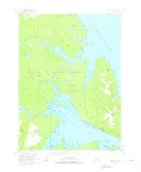
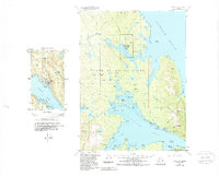
1949 Map of Craig C-2
USGS Topo · Published 1962About this map
The industrial and maritime landscape of Prince of Wales Island is deeply etched into this mid-century survey, revealing a territory defined by remote extraction and coastal dependence. The Kasaan Peninsula and the shores of Kasaan Bay are dotted with numerous workings, including the Salt Chuck Mine, Haida Mine, and Rush and Brown Mine. These mining operations, some connected by an Aerial Tramway near the Flagstaff Mine, illustrate the era's reliance on mineral wealth and complex logistics in the Alaskan wilderness.
Find a feature on this map
76 named features on this map. Tap any name to fly to it.
Don’t see what you’re looking for? This feature index may not catch every label — zoom into the map to look around manually.
Map Details
Editions of this 1949 Craig C-2 Map
3 editions found
Other maps of this area

1949 · Craig D-3
USGS Topo · 1:63,360

1949 · Craig D-2
USGS Topo · 1:63,360

1949 · Craig B-2
USGS Topo · 1:63,360

1949 · Craig B-3
USGS Topo · 1:63,360

1949 · Craig C-3
USGS Topo · 1:63,360

1949 · Craig B-1
USGS Topo · 1:63,360

1949 · Craig D-1
USGS Topo · 1:63,360

1950 · Craig D-3
USGS Topo · 1:63,360

1950 · Craig B-1
USGS Topo · 1:63,360

1950 · Craig C-1
USGS Topo · 1:63,360