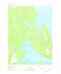
1949 Map of Craig C-2
USGS Topo · Published 1976About this map
Kasaan Peninsula and the eastern coast of Prince of Wales Island reveal a landscape defined by mid-century extraction and maritime transport. The settlement of Kasaan anchors the region, while the surrounding hills are marked by an extensive mining history, including the Salt Chuck Mine, Haida Mine, and It Mine. An Aerial Tramway near the Flagstaff Mine illustrates the mechanical solutions required to move ore through the coastal terrain.
Find a feature on this map
81 named features on this map. Tap any name to fly to it.
Don’t see what you’re looking for? This feature index may not catch every label — zoom into the map to look around manually.
Map Details
Editions of this 1949 Craig C-2 Map
3 editions found
Other maps of this area

1949 · Craig D-3
USGS Topo · 1:63,360

1949 · Craig C-2
USGS Topo · 1:63,360

1949 · Craig D-2
USGS Topo · 1:63,360

1949 · Craig B-2
USGS Topo · 1:63,360

1949 · Craig B-3
USGS Topo · 1:63,360

1949 · Craig C-3
USGS Topo · 1:63,360

1949 · Craig B-1
USGS Topo · 1:63,360

1949 · Craig D-1
USGS Topo · 1:63,360

1950 · Craig D-3
USGS Topo · 1:63,360

1950 · Craig B-1
USGS Topo · 1:63,360