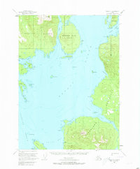
1949 Map of Craig D-1
USGS Topo · Published 1973About this map
The waters of Ernest Sound and Clarence Strait dominate this mid-century maritime survey of the Alexander Archipelago. This portion of the Tongass National Forest illustrates the remote industrial coastal life of Southeast Alaska, centered on the Cleveland Peninsula and Etolin Island. A primary focal point is the site of Cannery (Aband) near the mouth of Cannery Creek, reflecting the boom-and-bust cycle of the region's salmon processing industry.
Find a feature on this map
36 named features on this map. Tap any name to fly to it.
Don’t see what you’re looking for? This feature index may not catch every label — zoom into the map to look around manually.
Map Details
Editions of this 1949 Craig D-1 Map
3 editions found
Other maps of this area

1948 · Petersburg A-1
USGS Topo · 1:63,360

1948 · Petersburg A-2
USGS Topo · 1:63,360

1949 · Craig C-2
USGS Topo · 1:63,360

1949 · Craig D-2
USGS Topo · 1:63,360

1949 · Ketchikan C-6
USGS Topo · 1:63,360

1949 · Craig D-1
USGS Topo · 1:63,360

1950 · Craig C-1
USGS Topo · 1:63,360

1951 · Craig D-2
USGS Topo · 1:63,360

1951 · Bradfield Canal
USGS Topo · 1:250,000

1951 · Craig C-2
USGS Topo · 1:63,360