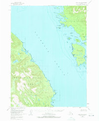
1949 Map of Craig D-2
USGS Topo · Published 1971About this map
Clarence Strait serves as the central waterway of this 1949 survey, separating the eastern shores of Prince of Wales Island from Etolin Island and Onslow Island. The maritime character of the region is defined by sheltered waters like McHenry Anchorage and Dewey Anchorage, which provided critical refuge for vessels navigating the Inside Passage. The coastline is marked by distinct landmarks such as Narrow Pt, where a Light is noted, and the logistical importance of natural harbors like Ratz Harbor and Little Ratz Harbor.
Find a feature on this map
32 named features on this map. Tap any name to fly to it.
Don’t see what you’re looking for? This feature index may not catch every label — zoom into the map to look around manually.
Map Details
Editions of this 1949 Craig D-2 Map
4 editions found
Other maps of this area

1948 · Petersburg A-1
USGS Topo · 1:63,360

1948 · Petersburg A-2
USGS Topo · 1:63,360

1949 · Craig D-3
USGS Topo · 1:63,360

1949 · Craig C-2
USGS Topo · 1:63,360

1949 · Craig D-2
USGS Topo · 1:63,360

1949 · Petersburg A-3
USGS Topo · 1:63,360

1949 · Craig C-3
USGS Topo · 1:63,360

1949 · Craig D-1
USGS Topo · 1:63,360

1950 · Craig D-3
USGS Topo · 1:63,360

1950 · Craig C-1
USGS Topo · 1:63,360